Posts

Showing posts from March, 2018

Possible new categories of social dog-walks

Image
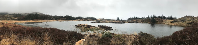
During our recent walks, and following some interest from members, we've identified some additional possible categories with which to label our social dog-walks. Here they are, and available for comment... We're keen to get some feedback on their relevance and value. We'd like to include just a few walk routes that may have a few obstacles that involve a bit of agility or ingenuity to pass. It may be a short scramble over some rocks, a short gradient that's a bit steeper than usual, or a section that's a bit slippery or particularly uneven in places. We'd like to include them because the destination or the overall experience is hugely worthwhile. Sometimes our walks get us to places that deserve a bit of exploration, with some care underfoot. We do avoid encountering anything overtly dangerous, but on such routes it's wise to be prepared with the right footwear, to be sure-footed, and to be ready to keep our dogs under closer control!

Hike - Cwm Teigl circular, near Llan Ffestiniog

Image
Cwm Teigl, in the shadow of Manod Mawr Short 3.5 mile hike along the route of the ancient roadway that once ran from Llan Ffestiniog through Cwm Teigl to Betws-y-Coed, in the shadow of Manod Mawr. Return by the path alongside Afon Gamallt, passing Hafod Ysbyty , which was once a 16th Century travellers' hospice. Limited roadside parking near the Horeb Chapel , or at various points further along Cwm Teigl. The first stretch along the lane from Horeb Chapel will need to be on lead, as it runs through some sheep pastures.No significant obstacles, mostly shallow gradients, though there is one short steep gradient linking the outbound route to the return route.                               

Walk - Slopes & forestry of Moelwyn Bach to Llyn-y-Garnedd

Image
Moderate 3.5 mile dog walk skirting across the slopes and forestry of Moelwyn Bach, using some good stone-surfaced forestry roadways. Llyn-y-Garnedd Uchaf Paddling Llyn-y-Garnedd Isaf Llyn-y-Garnedd Isaf is a good halfway point for a break. A bit of shelter at lunchtime! Parking is free at Tan-y-Bwlch Station (Ffestiniog Railway) Car Park. There are no stiles, three pedestrian gates, and a couple of pole barriers to duck under. The ascent is a long steady easy gradient, and the going is fairly even. There are usually no sheep grazing this section of forestry, so plenty opportunity to be off lead. The Cafe and Toilets at Tan-y-Bwlch Station are only open in season, when the trains are running.  The Oakley Arms is at the bottom of the hill, by the A487, and there are Public Toilets opposite, by the bus shelter. Directions : From A487 at Maentwrog, take the B4410 uphill from the Oakley Arms to Tan-y-Bwlch Station. Tan-y-Bwlch Station is well signposted

Short Hike to Dduallt via the Coed Cymerau waterfalls

Image
This is a short hike (just 2.5 miles) but is reasonably demanding (because of its steep and uneven/boggy initial ascent).  It's well worth the initial cardio-vasular push - because the waterfalls and forestry are charming and the vistas from the upland plateau, once you get there, are hugely rewarding. Manod Mawr and the Vale of Ffestiniog The upland circular walk goes through the unusual and picturesque Dduallt halt on the Ffestiniog Railway. There are some interesting railway artefacts, and it has a fascinating history. Rhoslyn Cottage, (once the Dduallt stationmaster's house) The ascent and descent route passes through both the Coed Cymerau and Coed Maentwrog nature reserves. There are some rich woodlands and charming waterfalls - serene places to take a breather and let the heart rate slow down! Footbridge by the waterfall in Coed Cymerau The route has more than its fair share of ladder stiles (in good condition) and a few low post-and-wire stiles (whic

Hike - Follow the Roman Road from Pont‑y‑Pant to Betws‑y‑coed

Image
This 4 mile walk starts with a short (8 minute) train ride from Betws-y-Coed to Pont-y-Pant. Pont-y-Pant Station The route follows the old Roman Road (Sarn Helen) gently up through the forestry and through the ancient abandoned village of Rhiwddolion. Abandoned Village Sarn Helen then descends to Pentre Du, the route back to Betws-y-Coed crossing the river by the Miners Bridge and returning by the riverside path. Miners' Bridge                                               What to bring You'll need to take about £2.60 train fare (or free if you have a Welsh Bus Pass!) Important to know The first half of this follows some narrow country lanes and eventually a bridle path. There are two straightforward road crossings, the first is straight across the A470 at Pont-y-Pant, and the second is straight across the A5 at Pentre Du. Riverside path An alternative to the riverside path into Betws-y-Coed is the unclassified road past Coedcynhelier Farm.